1 Youlgrave to Bradford Dale, Peak District
From Walker’s Britain In A Box
- Walk distance - 20km
- Difficulty - 4/5
From centre of Youlgrave, walk up the lane opposite the youth hostel as far as the car park beyond the old mineral works. Turn onto a signed footpath and walk across fields. Go through Calling Low farmyard, following the signs, and cross a series of fields, then descend steeply and cross Cales Dale on clearly defined path to One Ash Grange Farm.
Continue on the cart track until it turns right at the gate beyond the farm. Go through the gate and immediately turn left to follow the wall up the side of the field. Keep crossing fields and eventually the path joins a walled, grassy lane. Follow this the whole way to Monyash. Follow the road through Monyash village, turning right at the green opposite The Bull's Head. Leave the village on the Bakewell road.
Turn right at the signpost ‘To Lathkill Dale’. Follow the dale, keeping to the path, as far as the road bridge at Conksbury. Turn right across bridge, then turn left through the gate and follow this path to the road at Alport. Cross the road and enter Bradford Dale on a wide farm track. Continue along the dale on the path on the north side of the stream. Cross a clapper bridge and and continue up the dale. Pass the trout pools, then turn right and cross the stream on a wide stone bridge. Climb steeply through the woods back to Youlgrave.
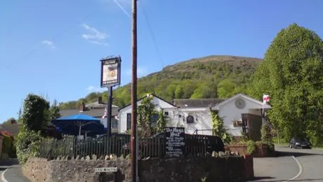
2 Nash Point to Monknash, Vale of Glamorgan
From glamorganwalks.com
- Walk distance - 8km
- Difficulty - 2/5
From the Nash Point car park, take the stony path which descends into the valley heading away from the sea. At the bottom go straight ahead, crossing the stream several times as you follow the path, and through the nature reserve until you reach the fence. Turn right and cross the wooden bridge. Head to the first house, turn left, cross the stream, then turn right and pass Marcross Church to your right. After two stiles, turn right along the road into Marcross village. Pass the Horseshoe Inn and then take the road to the left of a letter box.
Turn left at a gap in the fence (just past The Larks). Cross the fields until you reach a metal gate, then turn left down the road. At the next junction turn left towards Monknash. At the T junction by the Forge, go left, then turn right to the the Plough and Harrow.
Return to the Forge and follow the footpath signed Blaen y Cwm. Pass the ruins of Monknash Grange, then turn right when you reach a track, cross the stream and then go left across the field. After the double wooden gate, turn left, then cross a stream and take the path to the right going down to Monknash beach. Just before the beach, take the path to the left, which goes steeply up the hillside, then head back along the coast with the sea on your right. Turn back into the valley where you started, then ascend the far side to return to Nash Point.
3 Buckden and Yockenthwaite, Yorkshire Dales
From Collins Rambler's Guide: Yorkshire Dales
- Walk distance - 11km
- Difficulty - 4/5
A gallery footpath connects connects the National Park car park at Buckden, in Wharfedale, with the hamlets of Cray, Yockenthwaite and Hubberholme.
4 South Stoke and the Arun River, West Sussex
From Pub Walks by Mike Power via hall-woodhouse.co.uk
- Walk distance - 8km
- Difficulty - 2/5
Walk across the Black Rabbit’s car park to pick up the footpath in the corner and follow it to the river path. Follow this across a track by the bridge and through a couple of gates, then turn left when you reach the hamlet of South Stoke. After passing South Stoke Farm, turn right onto the bridleway. Turn left at the barn, cross the field, then bear right and enter the woods on the far side.
Follow the path and when you reach a signed gap go through and follow the path up the hill, bearing right at the track and then left. At the top bear right towards the corner of the small wood, following the track until a sign directs you to the right. Follow the fence over a wooden crossing point, join the track at the bottom and turn left.
If you want to walk through Arundel continue straight on towards the tower. Otherwise stay on the track until you reach the lake where you have two route options. Turn left onto the path, cross the road to the little path beside the reserve, then turn right. Bear left at the bridge, then follow the path around the reserve then along the river bank back to the pub.
5 Road To The Isles, Knoydart
- Walk distance - 30km
- Difficulty - 5/5
If you want to walk to Inverie from Kinlochhourn, Glenfinnan or anywhere else, contact the Ranger Service, which is able to provide help and advice on what can be an arduous trek.
For more great adventures, subscribe to the magazine. We'll give you five issues for £5. If you're allergic to paper, you can download a digital version of MF here.

